VisuGps
| FlyXC |
Visualiser vos propres vols sur les cartes de Google Maps VisuGps s'appelle maintenant flyxc.app Supporte les formats IGC, GPX et KML View your own tracks on Google Maps VisuGps is now flyxc.app Support for IGC, GPX, and KML formats Accéder au code source de FlyXC sur github |
VGpsLive


Suivez les vols en direct (GPS live tracking).
Comment ca marche ?
Vous pouvez maintenant utiliser flyxc pour le live tracking
Comment ca marche ?
GPS live tracking.
Please use flyxc for live tracking
How does it work ?
Telecharger le manuel de VGpsMobile. Applets pour mobiles java, blackberry et winmobile sur victorb.fr/m Download VGpsMobile user's guide. Applets for java, blackberry and winmobile phones on victorb.fr/m
- Dernière Infos:
- TrackUrTrail (iPhone) par David Barthelemy est compatible avec VisuGps live
- Andréa Barcellona a porté VisuGps sur Blackberry
- Skywind (iPhone) supporte VGpsLive - merci Hartwig
- PyTracker (Android) enfin sur Android, merci Andréa Barcellona
- Updates on the live tracking:
- TrackUrTrail (iPhone) by David Barthelemy supports VisuGps live
- Andréa Barcellona has modified VisuGps to run on BlackBerry phones
- Skywind (iPhone) supports VGpsLive - thanks Hartwig
- PyTracker (Android) is an other excellent work from Andréa Barcellona
Si vous possedez un telephone avec un GPS interne ou externe (bluetooth), vous pouvez installer VGpsMobile sur votre telephone.
Cette application Java enverra regulierement votre position au serveur pendant votre vol. Il sera alors possible aux personnes de suivre
votre vol en direct sur cette page VGpsLive. Contactez moi si vous voulez plus d'information sur le GPS live tracking ou pour obtenir
l'application J2ME a installer sur votre telephone et un compte sur mon serveur.
L'application VGpsMobile vous permet aussi de consulter la météo du lieu ou vous vous trouvez
(METAR provenant de geonames.org et bulletins fins météofrance) et de trouver les sites de décollage
dans les environs (base de données paraglidingearth.com).
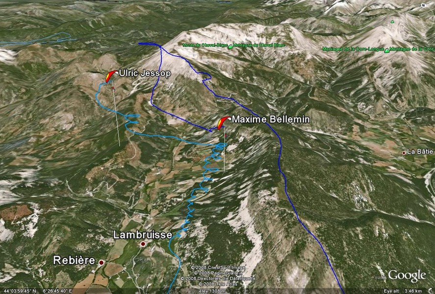
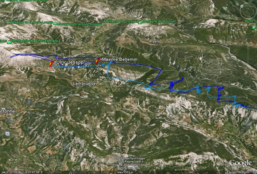
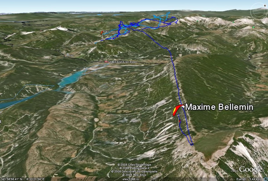
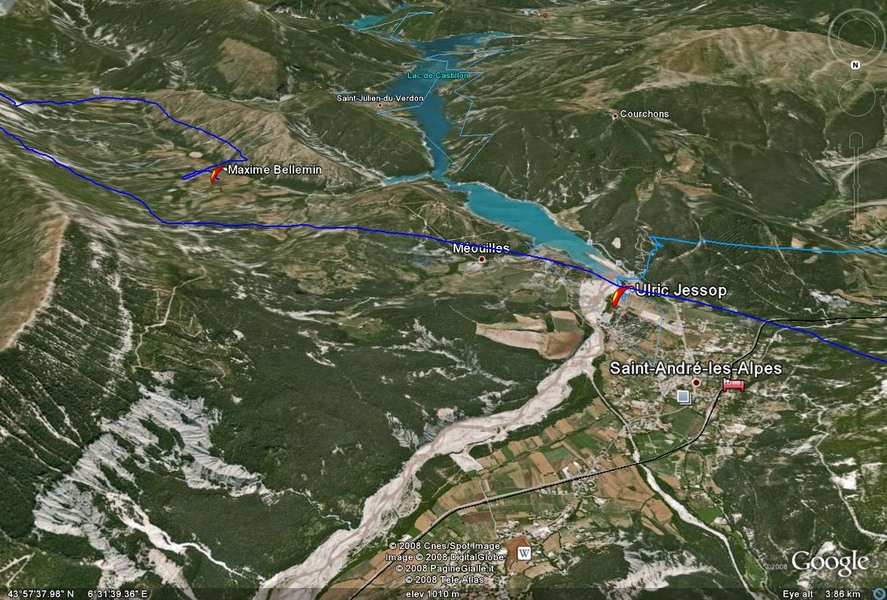
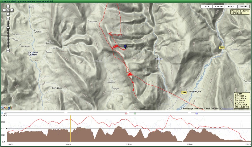
Sur cette page, la colonne Trace 2D permet de voir la trace en direct en 2D et necessite le plugin Flash Player.
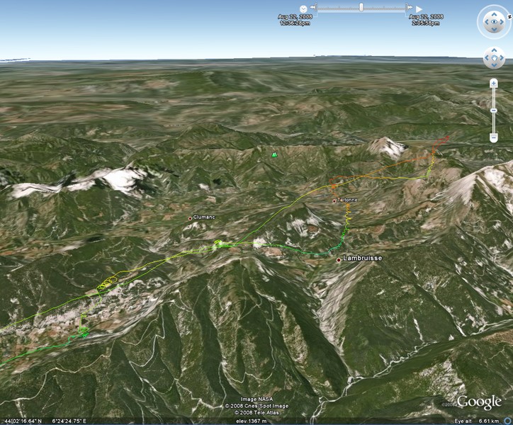
La colonne Trace 3D permet de voir la trace en direct dans Google Earth.
Il est egalement possible de telecharger la trace au format IGC ou KML.
You can install the VGpsMobile applet on your mobile phone provided you have either a bluetooth GPS or a GPS enabled phone.
The applet periodically sends your position to a server while you are flying enabling other people to track you via this web page.
Contact me if you need more information about GPS live tracking or to get an account on my server and the J2ME applet for your mobile phone.
The VGpsMobile applet allow to retrieve local weather information (provided by geonames.org) and local take-off information
(provided by paraglidingearth.com).
You can view a 2D by clicking the Trace 2D row on this webpage (Flash Player is required). By clicking on the
Trace 3D row, you can view a 3D track in Google Earth.
Test de la connection data
Selectionner le menu "Test data transfer" dans l'application VGpsMobile. Vous devez voir le message "Connection successful" sur le telephone.
Ensuite rafraichissez le tableau ci-dessous, l'ID inscrite sur le portable doit apparaitre. Sinon utilisez un autre point d'acces.
Data transfer
Select the menu item "Test data transfer" in the VGpsMobile application. Once the message "Connection successful" is displayed, refresh the
table below. The ID written on the mobile should appear. Otherwise try to use an other access point.